All projectsTrace
Software
Trace
HackHarvard 2026 · 1st Place, Best Data-Driven Agent (Chalk Prize) · Oct. 2026
1stplace, Chalk Prize
8.7hmedian warning
92%flood-free routes
85%burn-area match
Overview
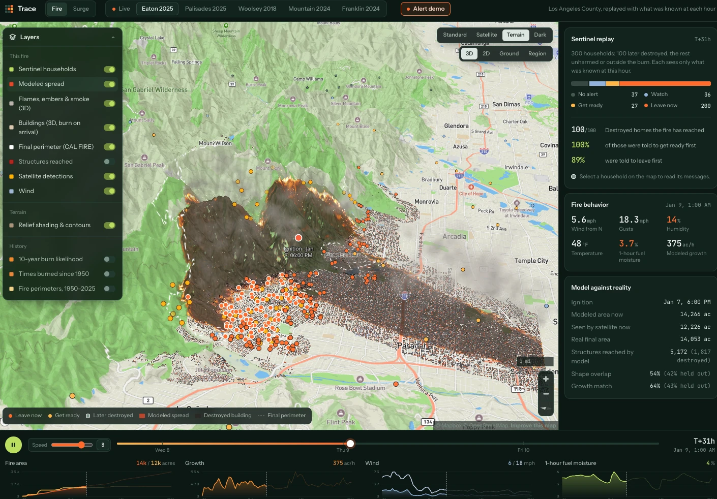
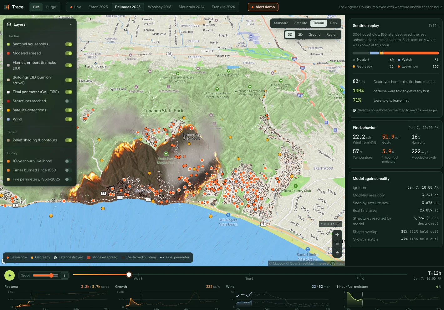
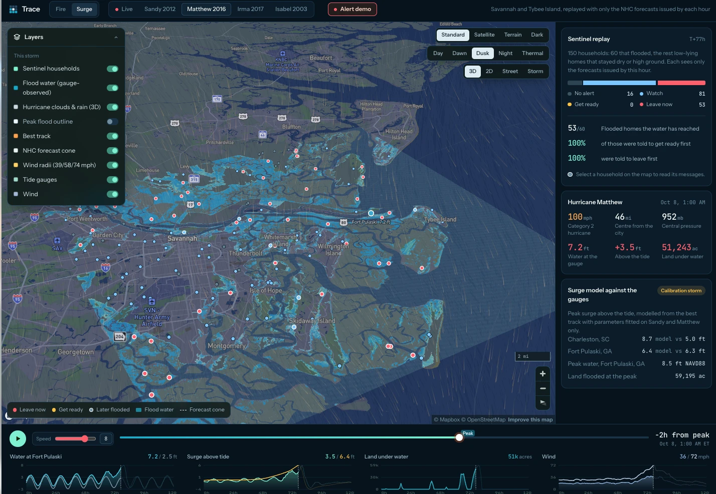
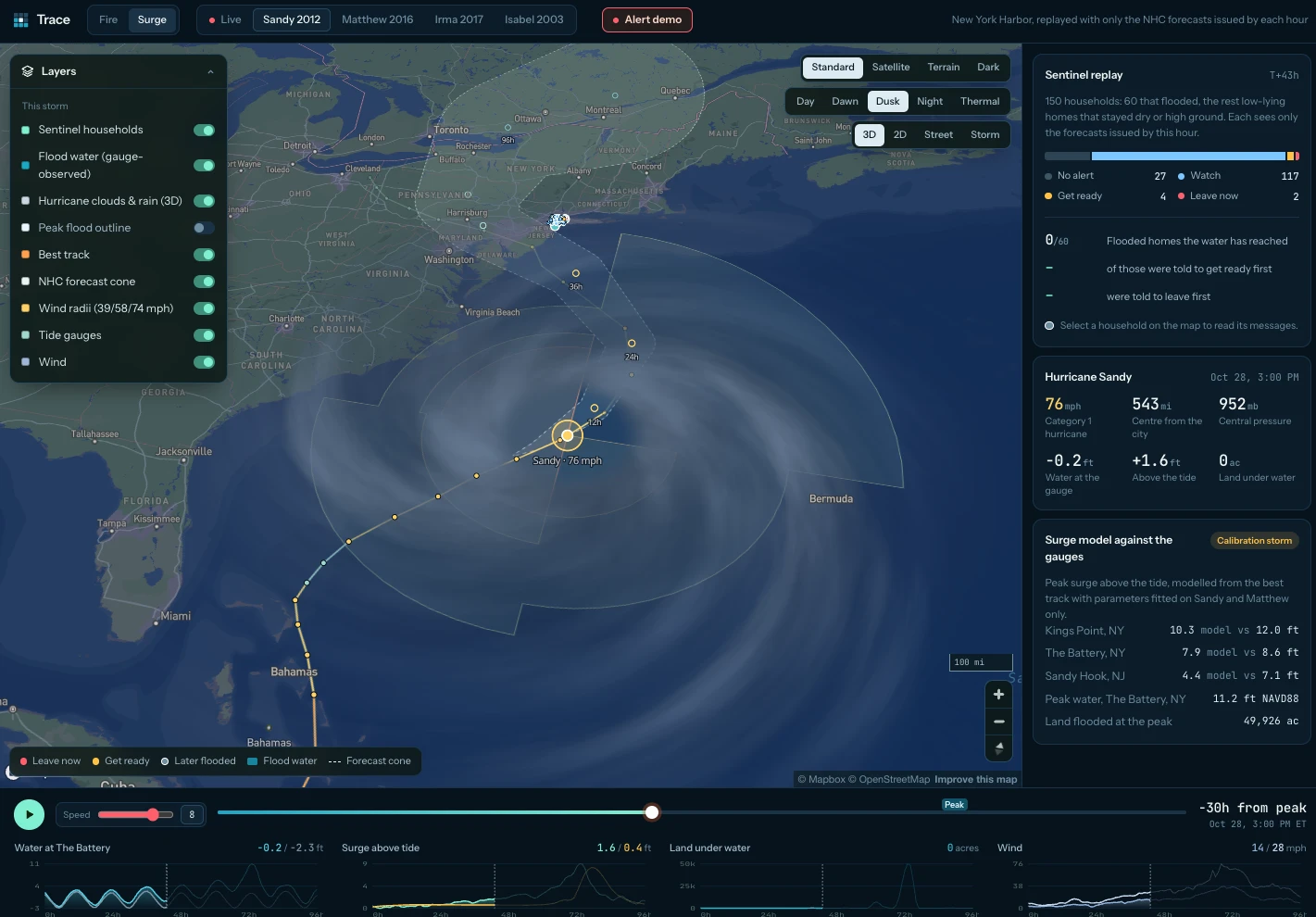
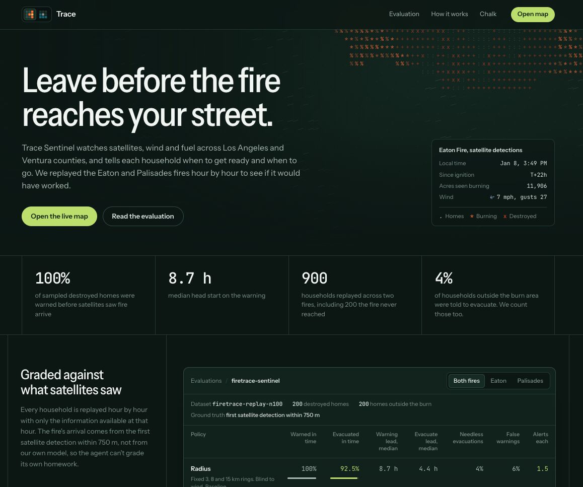
Autonomous AI disaster agent that warns people before a wildfire or storm surge reaches their home — address by address, not whole evacuation zones. Won 1st place for Best Data-Driven Agent (Chalk Prize) at HackHarvard 2026. Covers wildfires in LA and Ventura counties and hurricanes on the US East Coast. WHY WE BUILT IT While interning at Tesla in Nevada, our team lived through several nearby fires. Coming from Canada and the East Coast, we had no idea whether we were in danger and couldn't find reliable information on where the fires were spreading. Trace turns satellite and environmental data into warnings people can actually act on. WHAT IT DOES • Every 15 minutes, pulls NASA satellite fire detections, national fire perimeters, NWS warnings, NOAA hurricane advisories and tide gauges, and hourly wind, humidity and fuel dryness • For each home, estimates hours until the hazard arrives from distance, wind direction and local sensitivity, then decides: watch, warn, or evacuate • Texts over iMessage (via Photon) at the first warning; an ElevenLabs voice agent calls at evacuate and answers questions about the fire, its direction, and which way to go • Time-aware router plans the fastest safe route with turn-by-turn directions, a map, and the latest time to leave — and says so if no safe route exists • Two-way conversation: text NOW for a route, WINDOW for when to leave, STATUS for the latest, LEFT once you're out • Web app replays 5 real fires and 4 hurricanes hour by hour with shader-rendered fire spread, 3D buildings that burn on the fire's clock, a thermal view, storm-surge flooding, and a live map of hot spots and Red Flag zones HOW WE BUILT IT • Burn-probability model over 806,000 grid cells from CAL FIRE perimeters, USGS terrain and LANDFIRE fuels (AUC 0.74 on unseen 2015–2025 fires vs 0.71 for fire history alone) • Rothermel spread simulation on a 30 m grid with hourly wind and fuel moisture • Parametric storm-surge model fitted on Sandy and Matthew, validated on Irma and Isabel against NOAA tide gauges • Agent sees each event only as it was known at that hour, so replays never use hindsight; an LLM policy via Chalk's Model Gateway calls fire tools before deciding and distills its own mistakes into lessons • Time-aware shortest-path search on OpenStreetMap road graphs that closes roads the fire or water will reach within a safety margin • Ran on Chalk Sandboxes (24/7 alert loop + MCP server, web app, learning loop) with Chalk Evaluations for alert quality • Safety-critical facts — routes, timing, steps — come from code, never invented by the LLM RESULTS (no-hindsight replays) • Warned 100% of destroyed homes across 600 households in the Eaton and Palisades fires, a median of 8.7 hours ahead • 92% of Hurricane Sandy evacuation routes stayed clear of flooding, vs 60% for the fastest route (92% vs 65% for Irma) • Spread simulation overlapped 85% of the real Palisades burn area and reached 99% of destroyed homes • Surge rules evacuated 100% of flooded homes in time, a median of 30.6 hours ahead • Cut New York routing over 297,000 road segments from ~100 s to 1–3 s per request by vectorizing the wind model and replacing a spatial join with a grid lookup WHAT WE LEARNED Back every claim with data, especially when lives are at stake: honest evaluation showed simple distance rings still evacuate more people in time on two fires (92.5% vs 82.5%), and we report it.
Stack & Skills · 13 competencies
Python
React
Vite
Mapbox GL
three.js
WebGL Shaders
LLM Agents
Chalk
Photon
ElevenLabs
NASA FIRMS
NOAA
OpenStreetMap
Visual Evidence
Visual Evidence
More from Software